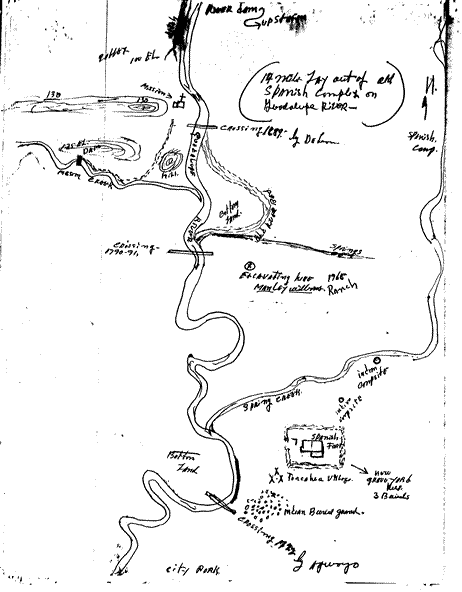
14 MILE LAYOUT OF OLD SPANISH COMPLEX
ON GUADALUPE RIVER

| East of river notations are: | West of river notations are: |
| Ditch 100 ft. elevation Mission 130 ft. elevation Dam 125 ft. elevation Hill Mission Creek Crossing used 1790-1791 Bottom Land |
River dam upstream Crossing 1689 by De Leon Spanish camp Bottom land Old river bed Springs Excavating here 1965 Manley Williams Ranch Spring Creek Indian campsites Spanish fort Toncahua village Now grave yard here 3 burials Indian burial ground Crossing 1722 by Aguayo City park |